


Roskosmos Publishes Space Images of the Popigai Crater
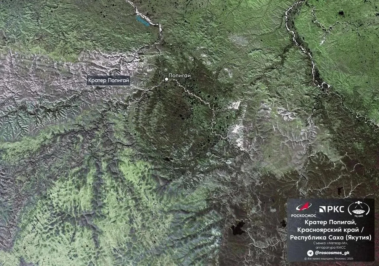
This was reported by Ixbt.com.
According to ixbt.com, the Popigai Crater, with a diameter of approximately 100 kilometers, is the fourth-largest impact crater on Earth. Experts say this enormous formation was created 35.7 million years ago when a celestial body crashed into the planet.
- Popigai Crater diameter: nearly 100 kilometers
- Formation period: approximately 35.7 million years ago
- Site status: included on UNESCO’s World Geological Heritage list
Unique geological area and “Pestriye skali”
The published photographs capture not only a general view from space but also notable landmarks in the area. One image shows “Pestriye skali” (Colorful Cliffs), where rocks were ejected by the force of the meteorite impact and have preserved traces of the ancient event to this day.Geographically, the Popigai Basin is located in the Anabar Plateau region. In its images, Roskosmos has shown not only the crater itself but also landscapes along the Anabar River, which flows through the region. This provides a better understanding of the geographic and ecological features of this remote area.
Global significance
The importance of this unique geological formation extends beyond scientific circles. In 1991, the Popigai Basin was included on UNESCO’s list of World Geological Heritage sites because of its distinctive geological features. This once again confirms how important the site is to the history of our planet.The latest space images demonstrate how precisely modern satellite technology can track traces of ancient catastrophes on Earth. This Roskosmos initiative will help science enthusiasts visualize what Earth looked like millions of years ago and serves as an important resource for studying the planet’s geological evolution.


Comments 0
…