World's Smallest Radar Satellite Begins Transmitting Earth Images
A significant breakthrough has occurred in the field of space technology: the "AIST-ST", considered the world's smallest radar satellite, has sent its first operational images to Earth. Developed by Russian engineers, this miniature device has practically proven its ability to monitor the planet's surface with high precision from space. This is reported by Ixbt.com news reports.
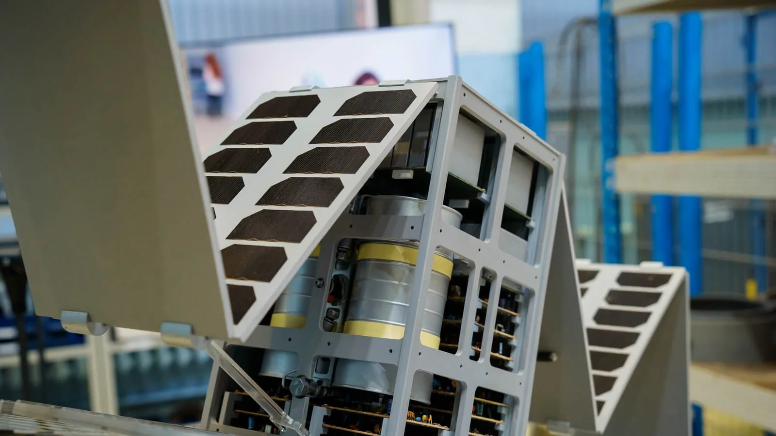
Created by specialists from Samara University and the Special Technology Center in Saint Petersburg, "AIST-ST" is the first radar satellite in CubeSat format. Launched into orbit on November 5, 2024, the device successfully completed post-flight tests and began performing its primary mission. According to ixbt.com, the apparatus has already provided frames depicting parts of Japan, the Panama and Suez canals, and the Rozamond area in the USA.
Technology independent of weather and time
The main feature of this satellite is its operation using radio waves in the centimeter range. Unlike ordinary optical cameras, this technology allows for clear "vision" of the Earth's surface even through thick clouds, fog, and total darkness of night. This is a crucial factor for agriculture, environmental monitoring, and emergency situation analysis."AIST-ST" is setting a record in global astronautics with its dimensions. Despite weighing only around 30 kg, it is equipped with a full-power radar. Typically, such complex equipment was installed on much larger and heavier spacecraft. The combination of small volume and high efficiency paves the way for creating affordable and rapid space monitoring systems in the future.
The images obtained so far were taken in route mode, with a resolution of 5 meters per pixel. Specialists note that the satellite will later be switched to a more detailed imaging mode, which will further increase the quality and accuracy of the acquired data.
The data obtained within the project have not only scientific but also economic significance. Using such miniature satellites, it is possible to form an entire network (constellation), allowing for real-time monitoring of any point on the Earth's surface. According to the plan, this miniature apparatus will remain operational for at least one year.


Comments 0
…